Verde River Hydrology
Path
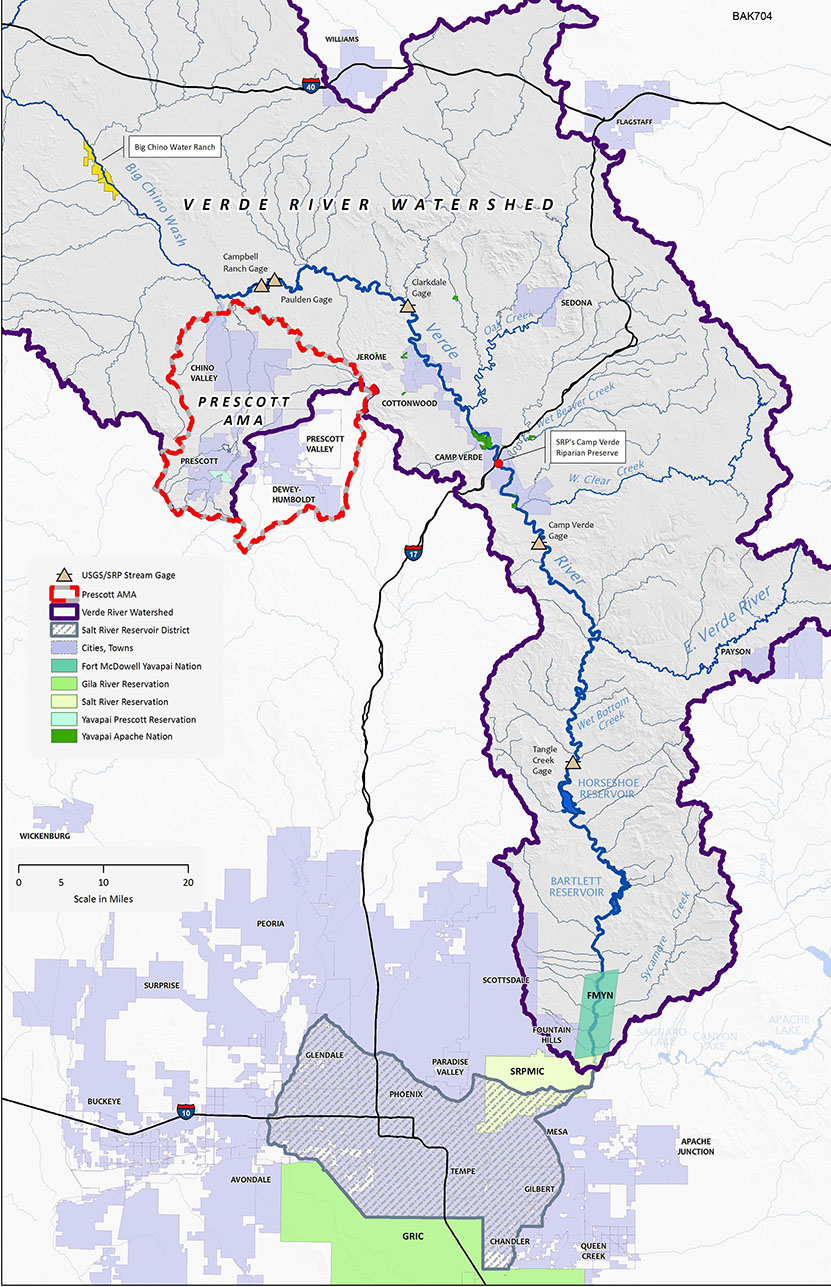
The Verde River continuously flows (perennial) from Verde Springs for 194 miles from Paulden to the confluence with the Salt River east of Scottsdale. It has maintained this path for over two million years. A summary of Verde River hydrology excerpted from the “Citizens’ Proposal for Upper Verde Wild and Scenic River “ can be downloaded here.Flow Pattern
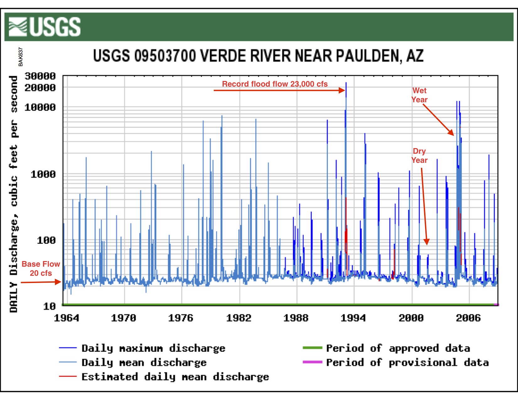
The flow of the Verde River shown on the above hydrograph is typical of Southwestern desert rivers. The hydrograph was generated from data collected by the USGS Paulden stream gauge (mile 9.8), and shows how the flow has changed over the years. The base flow (the lowest 3-day average flow) originates from springs fed by groundwater. River flow in excess of the base flow is from rain or snow and often appears as sudden spikes in the flow rate. These flash flood events can be enormous and are part of the natural ecology of the river.Base flow changes
However, for the next 15 river miles down to Perkinsville Bridge (mile 25) here are no significant springs supplementing the base flow and the river's flow decreases (a “losing reach”) because: a) some water seeps back into the streambed to reappear downstream, b) some water is used by riparian vegetation along the riverbank (transpiration), and c) water evaporates from the moist banks. The low flow recorded at Perkinsville Bridge was only 9 cfs.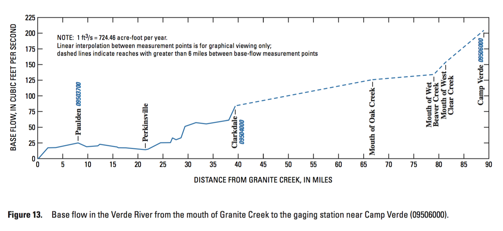 Between Perkinsville and the USGS Clarkdale stream gage (mile 37), northern aquifers supply many additional springs that add substantial amounts of groundwater to the river, thus the base flow at this site is approximately 70 cfs.
Source of Base Flow
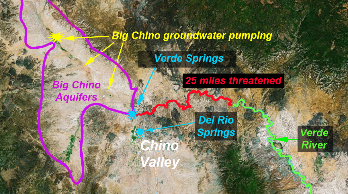
Groundwater pumping in the Big Chino Valley captures groundwater naturally destined to flow to Verde Springs, thus groundwater pumping in the Big Chino Valley is the largest threat to the Verde River. Planned and existing groundwater pumping projects in the Big Chino Valley will intercept groundwater destined for the river, just as pumping in Chino Valley now captures water from Del Rio Springs.
Unmitigated groundwater pumping in the Big Chino Valley will eventually turn the first 25 miles of the upper Verde River into a dry wash, destroying some of the finest surviving riparian habitat in the Southwest, exactly as it is now occurring at Del Rio Springs.