
Our understanding of the geology and hydrology of the Big Chino Valley is based upon extensive USGS studies including mapping, isotopic water analysis, geomagnetic and gravity studies, numerous test wells, and thousands of private well logs.
Big Chino Valley
 The Big Chino Valley (including Williamson Valley), contains a broad alluvial basin filled with alluvial, sedimentary, and volcanic deposits constituting the aquifers of the Big Chino Sub-basin. The Big Chino is one of the largest native grasslands remaining in the southwest and supports over 1000 pronghorn, one of the largest herds in the southwest. The terrain is primarily grassland with gentle relief. Abundant groundwater occurs at depths that range from a few feet to several hundred feet. Irrigated agriculture in the valley bottom has declined over the last several decades; now large cattle ranches occupy most of the valley.
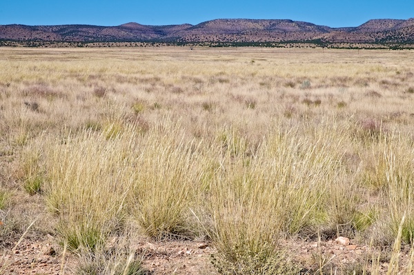
Hydrology
 The source of Big Chino groundwater is precipitation on the higher elevation mountains surrounding the valley bottom, primarily west of Williamson Valley and the Big Black Mesa northeast of the Big Chino Valley. Recharge occurs on the rocky mountain front and from runoff infiltrating into streambeds; essentially no recharge occurs from precipitation falling on the valley bottom.
The only surface water outlet for the Big Chino groundwater is Verde Springs, the headwaters of the Verde River. The US Geological Survey (USGS), the Arizona Department of Water Resources (ADWR), and other hydrologists agree that based on multiple lines of evidence, 80-86% of the water surfacing at Verde Springs originates from the Big Chino aquifers. The other 14% is from the Little Chino Sub-basin. Hydrologists also agree that the various rock layers comprising the Big Chino aquifers function as one aquifer, and that there is no “clay plug” that blocks groundwater flow from the NW Big Chino to Verde Springs.
Bathtub
 The Big Chino resembles a bathtub filled by a faucet at one end (recharge) and an overflow drain at the other end (Verde Springs). When the tub is full, the discharge from the overflow drain equals the flow from the faucet – an equilibrium condition representing the predevelopment groundwater system prior to groundwater pumping. If we pump some water from the tub - less than the recharge faucet inflow - the overflow will decrease by the pumped amount. If you pump more water from the tub than is flowing in, the water level will drop, the overflow will cease, and the amount of water in storage decreases until the tub is empty. It is especially important to notice that removing only a small fraction of the water stored in the tub will halt the overflow.
This is a direct analogy to the relationship between Big Chino groundwater and Verde Springs. Removing only a small amount of Big Chino groundwater – taking water out of the tub – will first diminish and then eliminate the base flow of the upper Verde.